In the five-year period from 2007 to 2011, SeaWatch SW has led a number of initiatives that are contributing to marine science and conservation in UK waters. These include:
- Collation of all Balearic Shearwater records from across the UK and Ireland to provide an up-to-date overview of the distribution of this Critically Endangered species. This approach generated several thousand records over the five-year period, and the results have been delivered in a report to JNCC and are included in a scientific paper that is currently undergoing peer review.
- Effort-based monitoring of marine life at Gwennap Head, Cornwall, which is at the southwest tip of the UK mainland. This survey work focussed on collecting information on the migratory behaviour of Balearic Shearwaters, but also collected data on all other seabirds, cetaceans, Basking Sharks and Ocean Sunfish. Dawn-to-dusk observations from 15th July to 15th October each year yielded 5000 hours of data, collected by scientists and postgraduate students, and supported by a team of dedicated volunteer observers. Results from the first three years are available in annual reports on the SeaWatch SW website.
- Tagging and tracking of Balearic Shearwaters at their breeding grounds in Mallorca and Menorca from 2010 onwards, using geolocators, GPS devices and Time-Depth Recorders. Initial results have provided new insights into the at-sea distribution and behaviour of this species, and are guiding implementation of marine Important Bird Areas (IBAs). The spring 2010 and 2011 expeditions have previously featured on the BirdGuides webzine.
- The project team at the National Oceanography Centre have recently focussed on generating scientific papers from these data, and completing PhD and Masters student projects. Over the coming winter, the intention is to publish the final SeaWatch SW report (for 2010–11 combined), and disseminate a summary of project achievements over the five-year survey period on the SeaWatch SW, Marinelife, and BirdGuides websites.
In 2011–12, the SeaWatch SW team have also been trialling more detailed mapping of marine life at Gwennap Head using a surveyors theodolite, which allows more accurate determination of the positions of animals in the water and aggregations of foraging seabird, than visual estimates alone. These trials have yielded excellent results, and we are now planning to apply this survey method to a specific conservation issue...and this is where we need your help!

Theodolite surveying at Gwennap Head, Cornwall, in January 2011 (Russell Wynn).
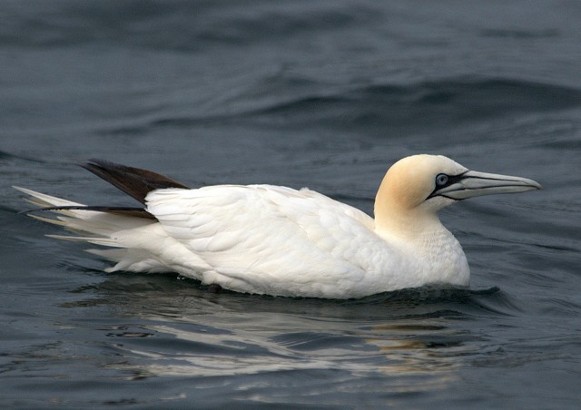
St Ives Bay in northwest Cornwall is an important midwinter foraging area for a variety of seabirds, in particular auks (Razorbills and Guillemots), Gannets, Kittiwakes and large gulls (mostly Herring and Great Black-backed Gulls). In the last decade, there have also been increasing numbers of the Critically Endangered Balearic Shearwater using St Ives Bay in the midwinter period, with peak numbers of up to 100 birds recently recorded (equivalent to 0.5% of the world population). However, records of all of these seabirds are sporadic and are typically based upon casual observations. Therefore, the spatial and temporal distribution of seabird foraging within St Ives Bay in the peak midwinter period is poorly understood.
In winter 2011/12 there was significant bycatch of seabirds in St Ives Bay (mostly auks), which featured in national media: see e.g. here, here, and here. Attempts to mitigate this bycatch include setting of nets at night and (through enforcement of a by-law) placing a temporary ban on commercial fishing within certain areas of St Ives Bay. However, without good-quality baseline information on the distribution of foraging seabirds in the area, the implementation of effective mitigation measures is likely to remain challenging.
SeaWatch SW is therefore initiating a new project, partnered by Marinelife and supported by the National Oceanography Centre, the Channel Coastal Observatory, the RSPB, Natural England, JNCC, and the Cornwall Inshore Fisheries and Conservation Authority (CIFCA), that will focus on the monitoring and mapping of seabird foraging aggregations in St Ives Bay in the midwinter period.
Gannet, St. Ives, Cornwall (Photo: Brian Mellow)
The project will have three components, all of which provide opportunities for volunteer observers to contribute:
- In suitable weather conditions (light/moderate winds and good visibility) we will undertake effort-based theodolite mapping of seabirds and cetaceans during all daylight hours on selected dates. The watchpoint will be alongside the National Coastwatch Institution lookout on St Ives Island, providing a good view across St Ives Bay (see http://www.nci-stives.org). The first phase of fieldwork will run from 6th–16th December 2012, with the second phase from 10th–28th January 2013. If you would like to assist with this fieldwork, please contact the project co-ordinator to receive further details.
- We are also looking to collate casual records of seabird aggregations in St Ives Bay in the period from 1st December 2012 to 31st January 2103, from both local and visiting observers. For this purpose, a seabird aggregation should be classed as more than ten birds in a roughly 10×10 m area. Records will need to include date, time, location with six-figure grid reference, number of birds, species composition, behaviour (including any interactions with fisheries) and the approximate location of birds within St Ives Bay. These records should be submitted to the project co-ordinator.
- We are also keen to hear from observers who would be prepared to undertake effort-based visual monitoring of seabird foraging aggregations in St Ives Bay within the survey period. Our recent experience at Gwennap Head has shown that visual mapping, using a compass bearing and estimated distance, has an error of ±300 m — this is sufficient to map foraging aggregations within the bay at a coarse scale. Ideally, this monitoring would be done in full-day (8-hour) or half-day (4-hour) blocks. Please contact the project co-ordinator for details.
At the end of the winter, we will provide a summary report to all project partners and observers based on the records obtained (including looking at temporal distribution trends), as well as initial maps of seabird foraging distribution in St Ives Bay based upon visual and theodolite mapping. So if you are looking for some incentive to get in the field in the midwinter period, consider contributing to this project and helping us reduce the future incidence of seabird bycatch in this area. All records and offers of assistance will be gratefully received!
